Landsat 8 Image Classification using QGIS

24:28
Landcover Change Detection using Landsat 8 (Australian Forest Fires 2019-2020)

2:38:03
NASA ARSET: Introduction to Land Cover Classification and QGIS, Part 1/2
26:15
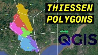
Analyzing the Areas of Influence with Thiessen Polygons using QGIS

27:53
Landsat 8 Image Classification with ArcGIS (Supervised)

3:58:39
Tüm Negatif Enerjiyi Ortadan Kaldırır, Tibet Şifa Flütü, Zihinsel Gücü Artırır

2:19:58
Deha 27. Bölüm

21:13
Supervised Image Classification with QGIS

13:39