GIS overlays special analysis

28:32
Interference figures

30:40
Different components of GIS

46:07
Weighted Overlay in GIS

12:56
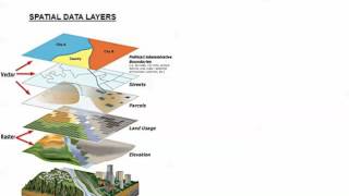
Vector and raster overlaying

26:58
Hydrological modeling with GIS

22:17
Thermal remote sensing and its applications
22:32
Introduction to GIS

32:49