Como obter curvas de nível utilizando Google Earth + QGIS + AutoCAD

17:05
Como obter curvas de nível utilizando Formit + AutoCAD
31:35
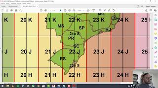
MAPA de CURVAS DE NÍVEL (TOPOGRAFIA) do zero (DEFINITIVO)

40:01
COMO USAR O GOOGLE EARTH PRO

4:10
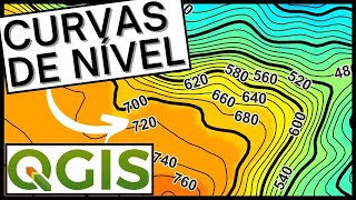
Como gerar CURVAS DE NÍVEL NO QGIS [2024]
22:32
Como georreferenciar imagens utilizando o AutoCAD (recurso Geolocation) e o Google Earth.
15:30
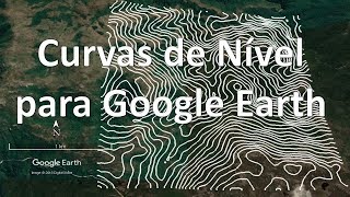
Como criar curva de nível para o Google Earth e outros programas

8:39
Como é fabricada a RÉGUA! #Boravê

20:48